

Satellites for Sustainability:
A deeper look

Satellite communications and space technology are becoming increasingly important in helping to impact some of the most pressing global challenges. Devex takes a deeper look at some humanitarian and development projects using space technology.
In the current era of globalization and interconnectedness, the need for connectivity is growing around the world and development actors frequently depend on reliable communications to do their work.
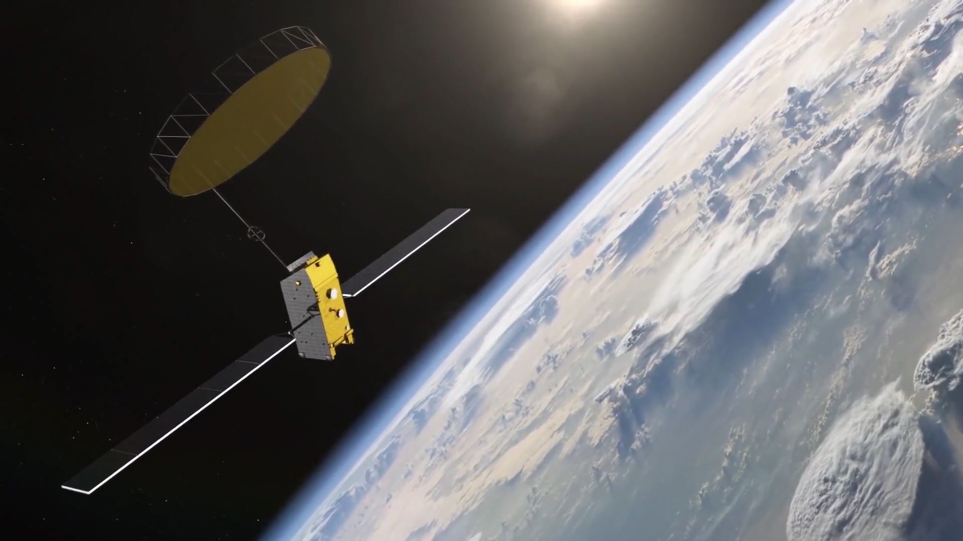
Satellite communications and space technology, in particular, are increasingly relevant to global challenges, and the benefits cut across development sectors — whether improving people’s lives by helping relief agencies and first responders get information in and out of disaster zones; reducing illegal fishing and improving safety and livelihood security; or increasing connectivity to provide better access to health care providers for patients in remote and rural areas.
Inmarsat’s Vice President of Government Engagement James Cemmell explains the role of satellites in solving global problems.
Inmarsat — the leading provider of global mobile satellite communications services — was founded 40 years ago to deliver solutions within maritime safety and distress. James Cemmell — the company’s vice president of government engagement —explains how it’s now going beyond that to address other challenges.
“The idea of satellites to address global challenges isn't a new one, it’s 40 years old,” he said. “However, now we’ve seen the world take a focus on the Sustainable Development Goals, which puts more of a robust agenda behind a whole set of activities — and satellite [technology] has a role to play in many of them.”
As part of the U.K. Space Agency’s International Partnership Programme, which co-funds U.K.-based operators tackling environmental and social challenges in developing countries, Inmarsat is deploying satellite communications equipment in pilot regions to help maintain communication channels should an earthquake or other natural disaster strike.
What is the International Partnership Programme?
The UK Space Agency’s International Partnership Programme — part of the U.K. government’s Global Challenges Research Fund, supporting the U.K.’s official development assistance commitment — is a £152 million ($199 million) multi-year program launched in 2015. It uses U.K. organizations' space knowledge, expertise, and capability to provide a sustainable, economic, or societal benefit to undeveloped nations and developing economies.
Read more: Turning UK aid into sustainable space projects


Graham Turnock, chief executive, UK Space Agency, explains how the International Partnerships Programme is helping to solve global challenges.
Read more: Making satellite technologies work for sustainable development
Disaster response in the Philippines
With natural disasters and other extreme weather events on the rise, how can satellite technology help relief efforts?
Recent catastrophes — including hurricanes in the Atlantic basin, heavy monsoon rains in India, Nepal, and Bangladesh, and a landslide in Sierra Leone — are poignant reminders that natural disasters and other extreme weather events are on the rise. Reaching the objectives outlined in the SDGs, the Paris climate agreement, and the Sendai Framework for Disaster Risk Reduction will be essential to mitigate the impact of those events. This, in turn, will require the global development and humanitarian aid communities to form efficient partnerships with space agencies and satellite operators, as well as advocate for more equitable data sharing practices between countries.
Responding to natural disasters using space technology
One of the most intense typhoons on record, Typhoon Haiyan — also known as Super Typhoon Yolanda — made landfall in the Philippines in November 2013, causing extreme damage to electricity and telecommunications infrastructure. It left many without access to critical information and unable to contact their families.
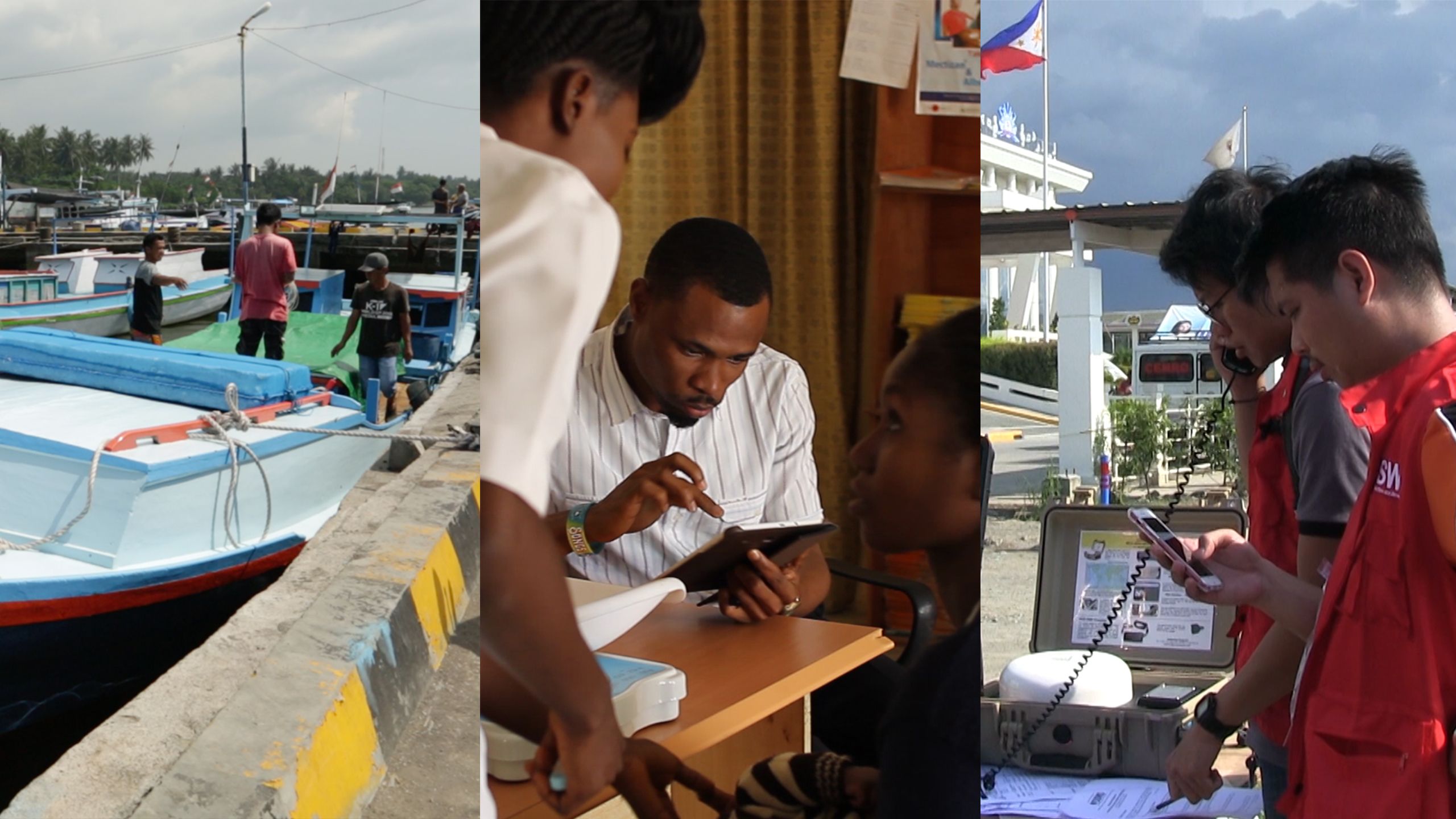
“The usual communications devices that we use in other disaster operations were not effective in establishing communications for Typhoon Haiyan,” said Lawrence Dimailig, officer-in-charge at the Disaster Response Operations Monitoring and Information Center in the country’s Department of Social Welfare and Development.
Residents needed to call their relatives to let them know they were safe.
Typhoon Haiyan, which hit the Philippines in 2013, caused massive amounts of disruption to telecommunications infrastructure.
“We went so far as to call it ‘communication is aid,’” he said, adding that the department worked to provide emergency satellite telecommunications for disaster response operations, beginning in Tacloban City.
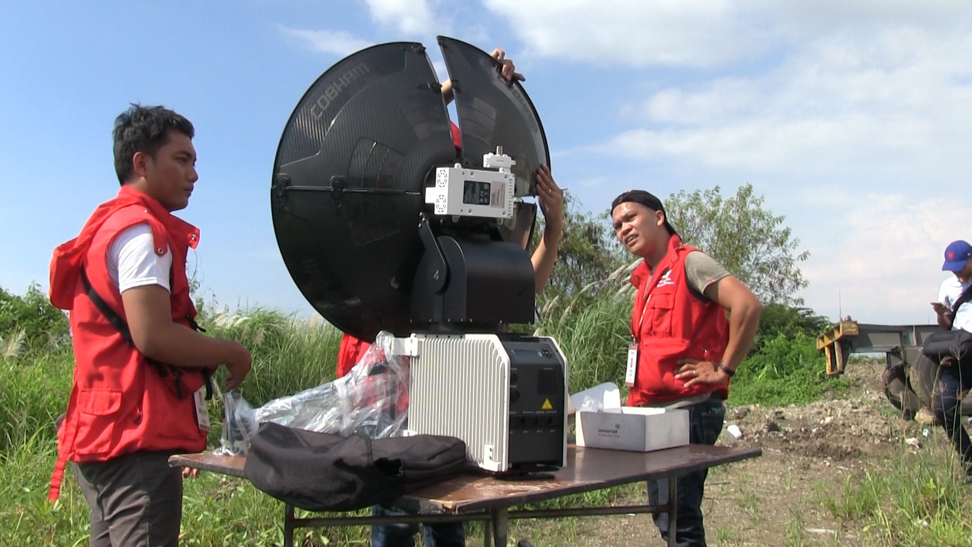
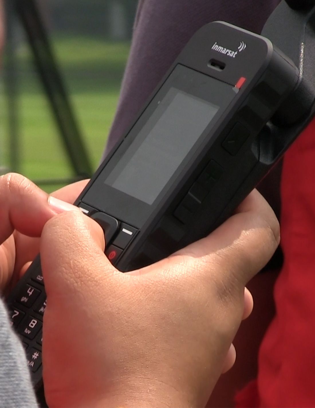
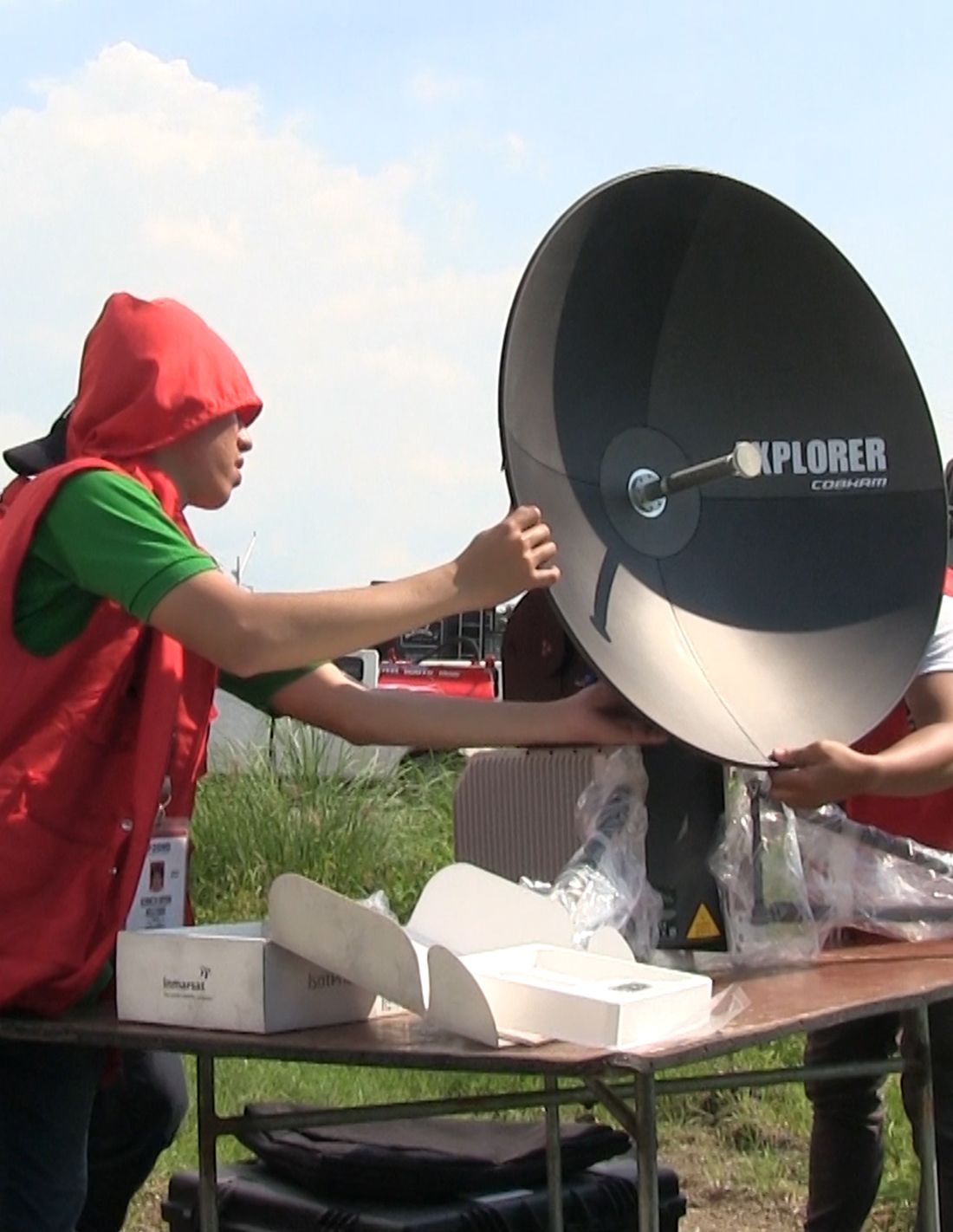
Four years on, efforts are underway to transform emergency communications in the Philippines. First responders in five high-risk regions of the country now have access to mobile satellite equipment that’s more powerful and easier to deploy. Satellite communications company Inmarsat, the UK Space Agency, and a consortium of partners are behind the project, which provides responders with the advanced satellite communications technology needed in the event of a natural disaster in places where communications infrastructure is down.
“We are investing so much in satellite telecommunications because we know in the future this will be the most reliable form of communications and the most mobile for the Philippines to deploy in every part of the country.”
Read more: How satellites help the Philippines respond to natural disasters

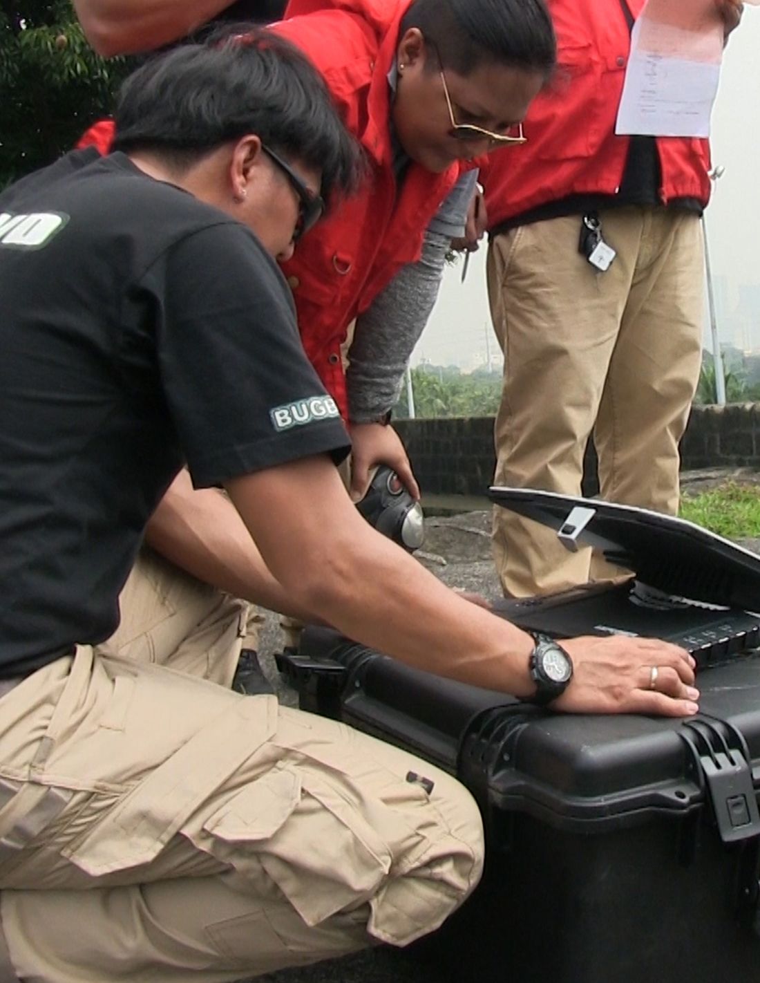
First responders in five regions of the Philippines are being trained on how to use mobile satellite communications equipment.
First responders in five regions of the Philippines are being trained on how to use mobile satellite communications equipment.

Satellite communications company Inmarsat, the UK Space Agency, and a consortium of partners are behind the project.
Satellite communications company Inmarsat, the UK Space Agency, and a consortium of partners are behind the project.

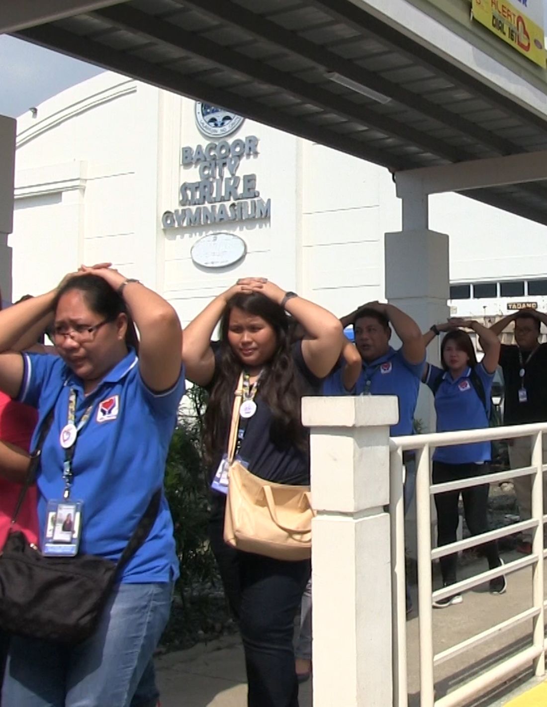
An emergency evacuation drill in Bacoor City, Cavite province.
An emergency evacuation drill in Bacoor City, Cavite province.

The Global Xpress satellite terminals are powerful yet easy to deploy in the event of a disaster.
The Global Xpress satellite terminals are powerful yet easy to deploy in the event of a disaster.
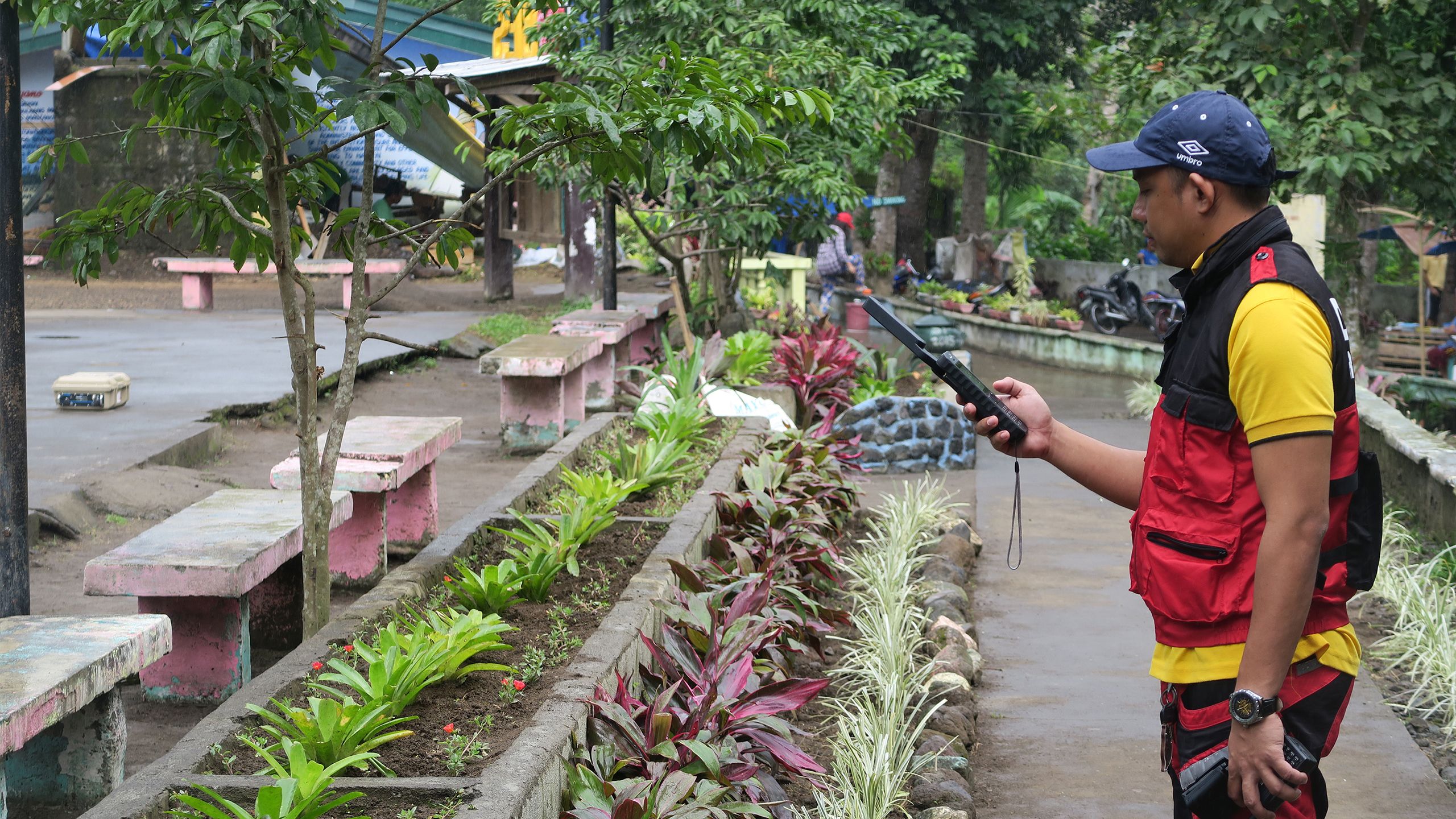
Satellite communications power response to Mayon Volcano
In January 2018, an ash eruption from Mount Mayon Volcano in the Philippines sent provincial disaster officials scrambling to evacuate residents within the 6-kilometer radius of the permanent danger zone. Within weeks, after Mayon spewed an ash column 5 km high, officials placed the entire province under a heightened alert, warning of an imminent hazardous eruption. School and work were suspended, air travel was canceled, and the ash destroyed an estimated $3 million worth of agricultural crops.
Devex visited the site three months on, when the Philippine government was still executing a massive relief effort that requires moving nearby residents to safety, temporarily resettling them in evacuation centers, and providing the food and nonfood items they need to survive.
Various national and local agencies and stakeholders are involved in these efforts, including the Office of Civil Defense — which oversees the Mayon operation; the Department of Social Welfare and Development — which leads the monitoring of evacuation centers; and the Department of Public Works and Highways —which monitors road networks and river channels, and supervises the construction of facilities in evacuation centers.
Read more: Satellite communications power response to Mayon Volcano


Access to health care in remote
areas of Nigeria
In a country where the vast majority of health data is still recorded by hand on registries, Devex visits a project with potential to revolutionize health coverage in Nigeria.
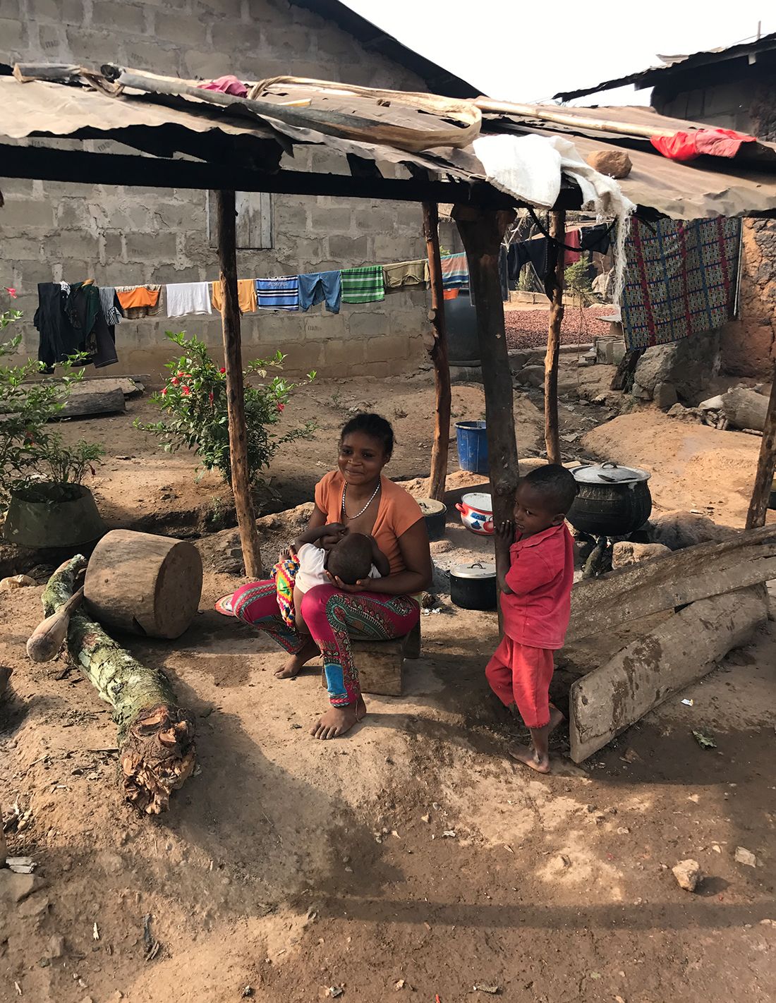
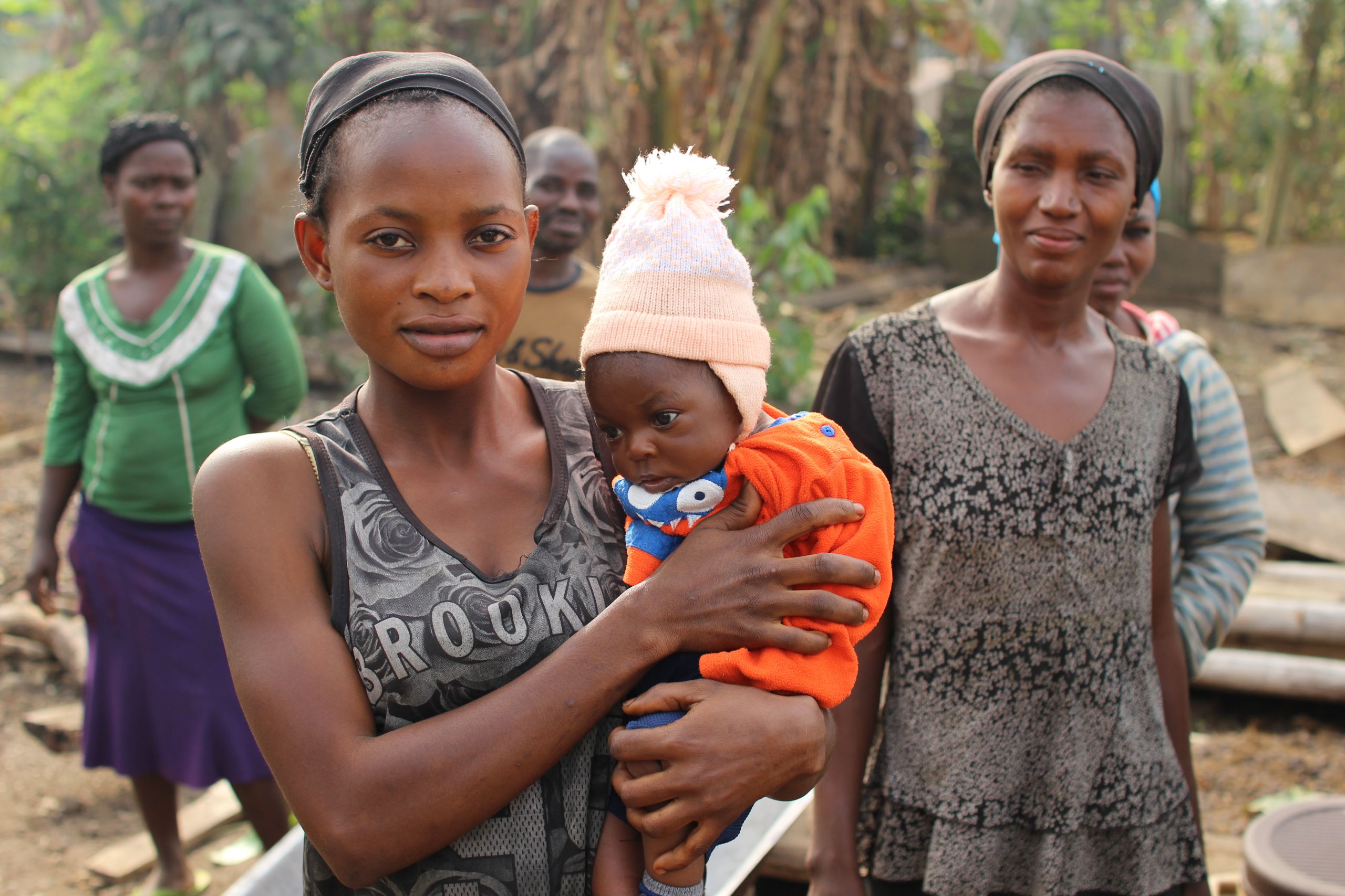
It takes nearly an hour to drive from Akure — the Nigerian capital of Ondo state — to the remote, palm-flecked village of Aseigbo. That’s on a clear day. During the wet season, the narrow, dirt road leading to the village turns to churning mud, virtually cutting off the small community from the outside world for months at a time, until the season changes and the ground dries. Phones don’t work here; it’s outside the range of any cell tower. Nor do most homes have electricity or indoor plumbing. In case of emergency or an outbreak of disease, it might take the central authorities weeks — or even months — to mobilize a proper response.
At least, that’s how things worked before the satellite receptors were introduced. Today, thanks to a partnership, not only is Aseigbo on grid — allowing local health care workers to contact central authorities at the touch of a button — but they are able to record patients’ health data via tablet, which can immediately be uploaded to a cloud. In a country where the vast majority of health data is still recorded by hand on registries, if taken to scale, the project has the potential to revolutionize health coverage in Nigeria.
The partnership between Inmarsat, the UK Space Agency, and Nigerian health company Instrat Global Health is helping deliver internet connectivity to rural health centers.
When people think about the many applications of satellite technology, improving health care delivery in the developing world is probably not the first thing that comes to mind, but the new International Partnership Programme aims to do just that. By combining satellite networks with tablet technology, the project partners hope to launch Nigeria’s health system into the modern digital world.
While today the UK Space Agency and Inmarsat donate much of the technology — including the satellites — Okey Okuzu, Nigerian diaspora professional and former director of strategy and innovation at pharmaceutical giant Novartis, believes that one day, the IPP project can be self-sufficient: “There are always private companies who will want to buy the sort of data that we are collecting,” he said. “Once we reach a critical mass, it can fund itself.”

Thanks to satellite receptors installed in the health center, the village of Aseigbo is now on grid. Photo: Malia Politzer
Thanks to satellite receptors installed in the health center, the village of Aseigbo is now on grid. Photo: Malia Politzer

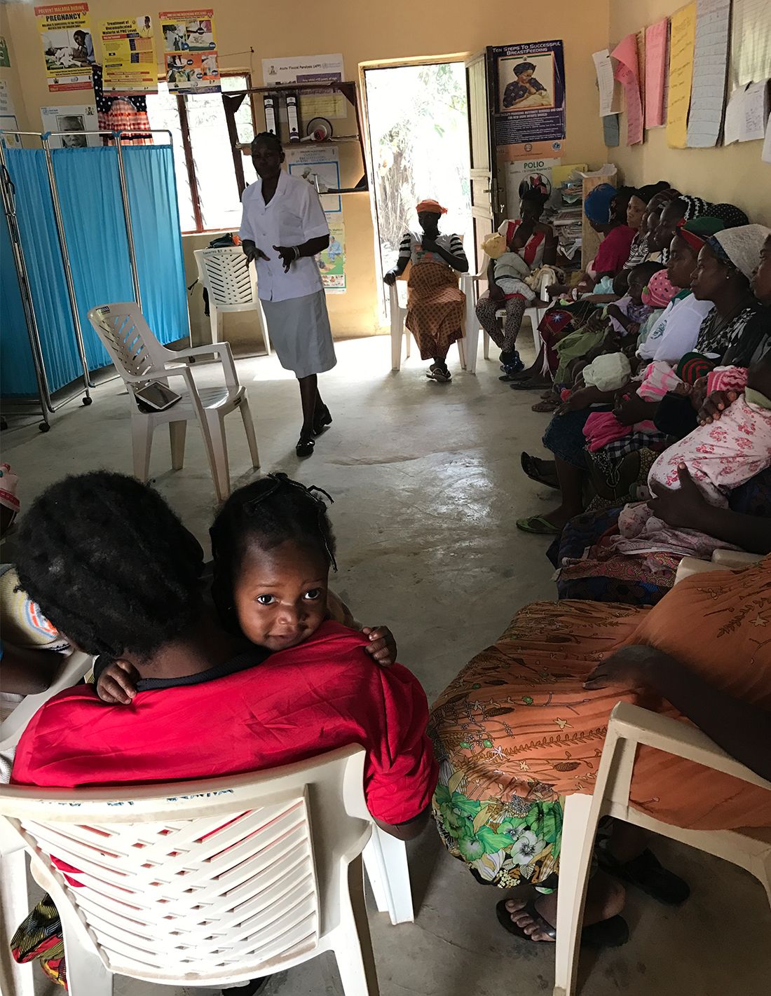
Women attend a breast-feeding workshop, which makes use of video training streamed on tablets. Photo: Malia Politzer
Women attend a breast-feeding workshop, which makes use of video training streamed on tablets. Photo: Malia Politzer

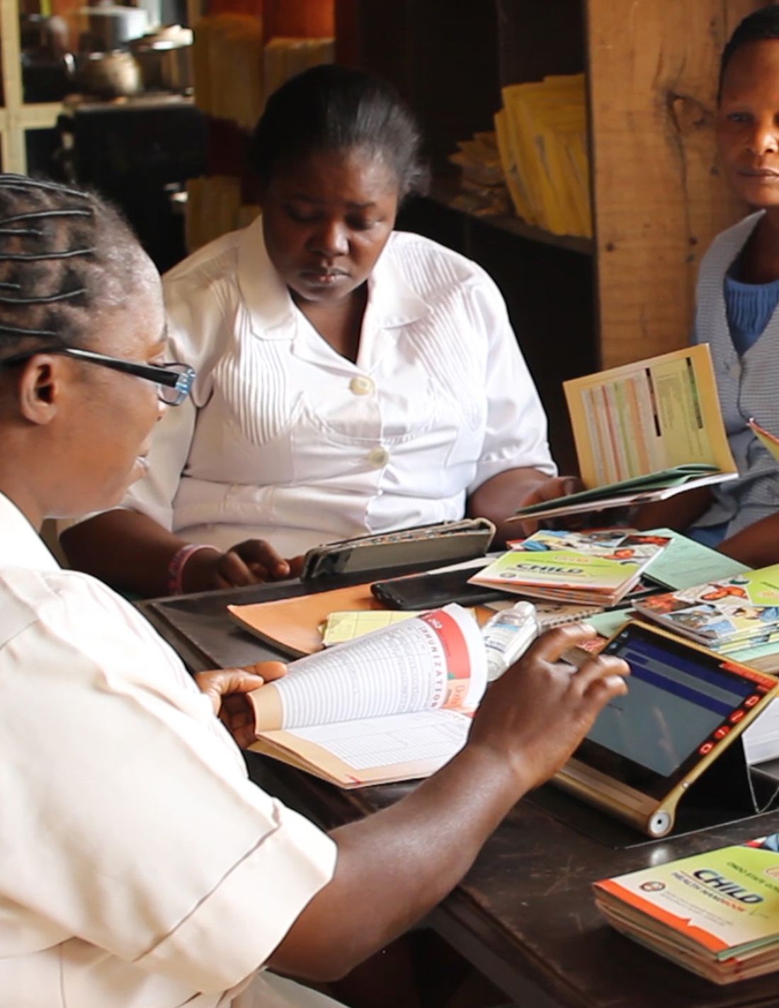
Health workers are now digitally recording patient data, resulting in more efficient and accurate record-keeping.
Health workers are now digitally recording patient data, resulting in more efficient and accurate record-keeping.

Despite having the biggest economy in Africa, Nigeria has the third-highest infant mortality rate in the world.
Despite having the biggest economy in Africa, Nigeria has the third-highest infant mortality rate in the world.
Despite boasting the biggest economy in Africa, Nigeria faces formidable health challenges: a 2017 UNICEF report found the country to have the third highest infant mortality rate in the world. One major contributing factor is a human resource gap. The World Health Organization identified Nigeria as one of 57 countries with a critical shortage of health care workers, far fewer than the threshold of 2.3 doctors, nurses, or midwives per 1,000 people to ensure minimal access to health care for all.

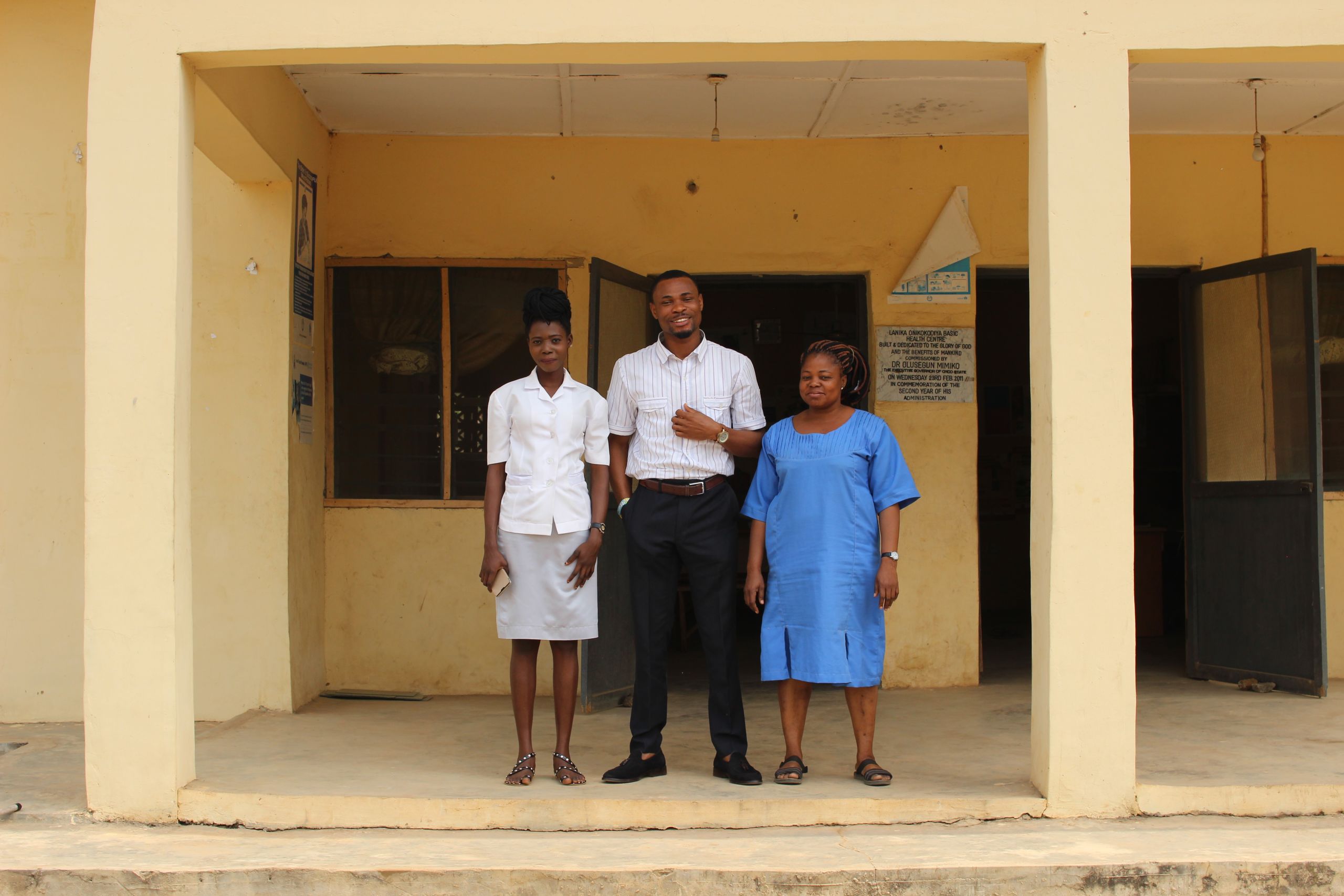
Health workers at Onikokodiya rural health center, in Nigeria's Ondo state, now have access to video training and digital data collection tools.
Health workers at Onikokodiya rural health center, in Nigeria's Ondo state, now have access to video training and digital data collection tools.
Nigeria’s health information system is also primarily paper-based, which means that before a patient can be treated, their data needs to be recorded on paper rosters then transferred by hand from one health care provider to another. It’s a system that can lead to significant delays and data loss — particularly when patients are referred to secondary or tertiary health care facilities.
Thanks to satellite-generated networks, video training via mobile technology can be made available in even the most rural areas of developing countries. These videos have become life-saving teaching tools, giving rural health care workers access to invaluable information at the touch of the button.
Read more: The potential impact of video-based education on health care workers
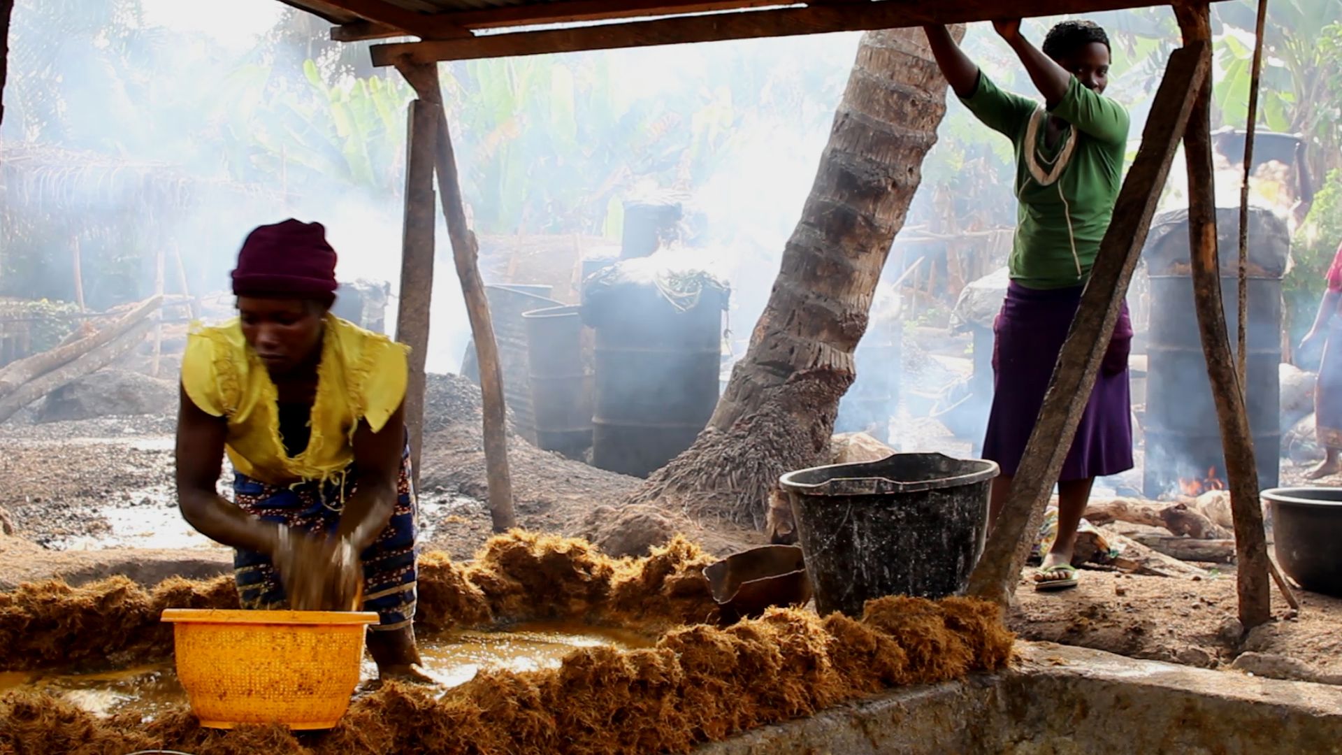
Connectivity matters for sustainable fishing in Indonesia
How could the use of space technology help combat a major threat to secure livelihoods for fishermen — illegal, unregulated, and unreported fishing? Devex visits a project in Indonesia that aims to help solve the problem.
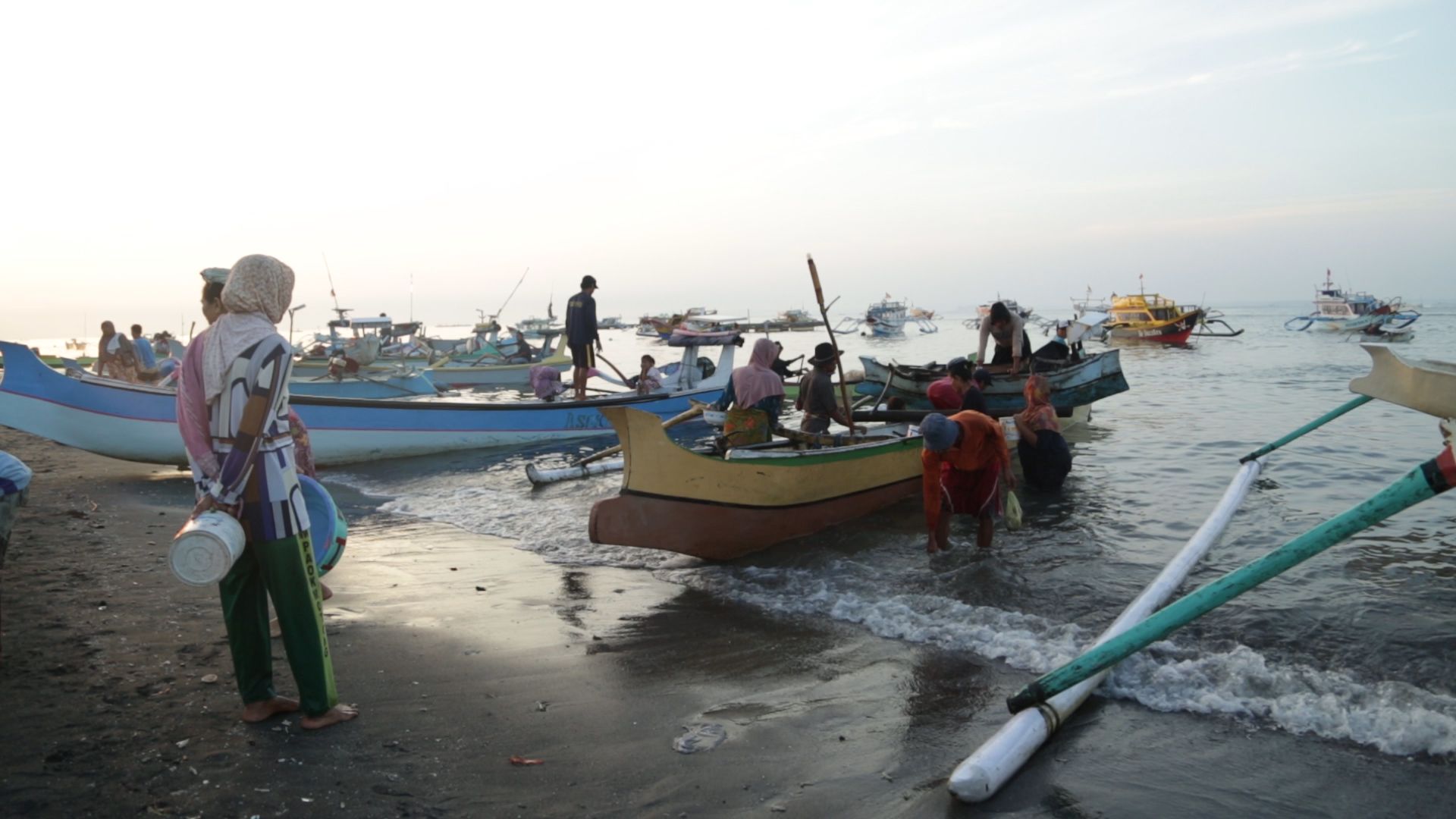
There was no land in sight when the engine stopped and the fishing boat that Arman was captaining began to drift. Huge waves came crashing down around the Indonesian vessel — typical in the vast tropical waters between the country’s distant islands. But with no way of contacting the shore and only a small supply of food on board, the crew had no alternative but to wait, trying not to panic, with their families left unaware of what was happening. This lasted for two days and two nights, before another boat happened to pass by and towed them to shore.
Indonesia's fragile marine ecosystem is under threat due to the impacts of climate change, damaging fishing practices, and overfishing.
Eight years later, Arman — who like many people in Indonesia only uses his first name — recounted this episode calmly as he prepared his boat for a routine three-week long fishing trip. Times have changed. His brightly painted vessel is one of 200 now installed with POINTREK, a Vessel Monitoring System, or VMS, which uses satellite technology to track fishing vessels and provide connectivity to the crew and coordinators on land.
“Now if we have an accident we aren’t too worried because we can communicate with people on land and other vessels,” said Arman. “When our friends [the other fishermen] are at sea they can inform us when they face bad weather and rough waves … and we can give information about our coordinates.”

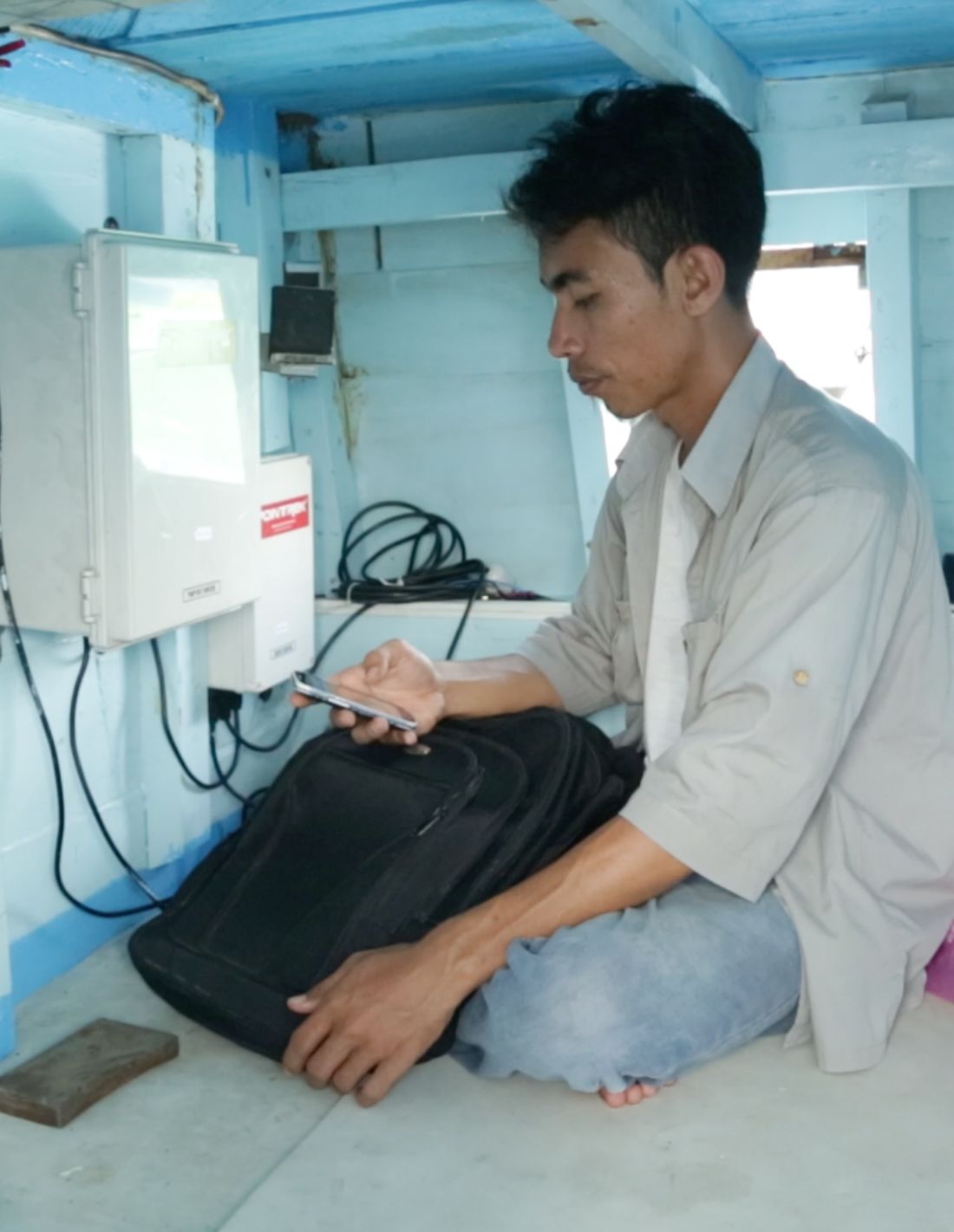
POINTREK, a Vessel Monitoring System, or VMS, uses satellite technology to track fishing vessels and provide connectivity to the crew and coordinators on land.
POINTREK, a Vessel Monitoring System, or VMS, uses satellite technology to track fishing vessels and provide connectivity to the crew and coordinators on land.

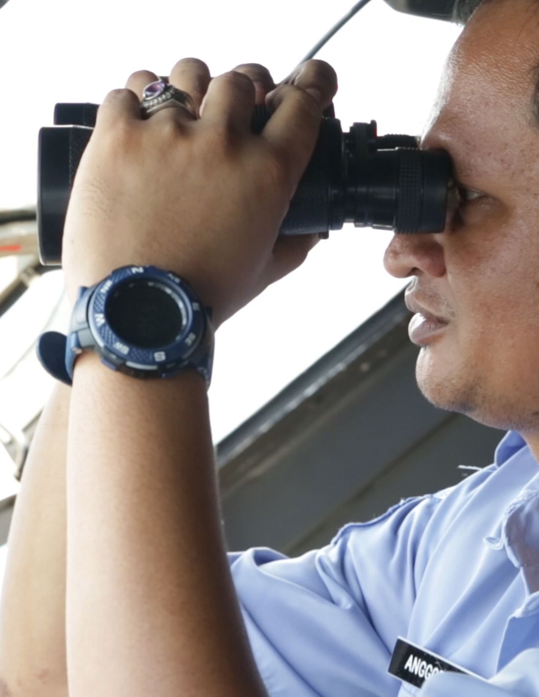
The VMS device is also used by a patrol boat with the aim of helping prevent illegal, unreported, and unregulated — or IUU — fishing.
The VMS device is also used by a patrol boat with the aim of helping prevent illegal, unreported, and unregulated — or IUU — fishing.

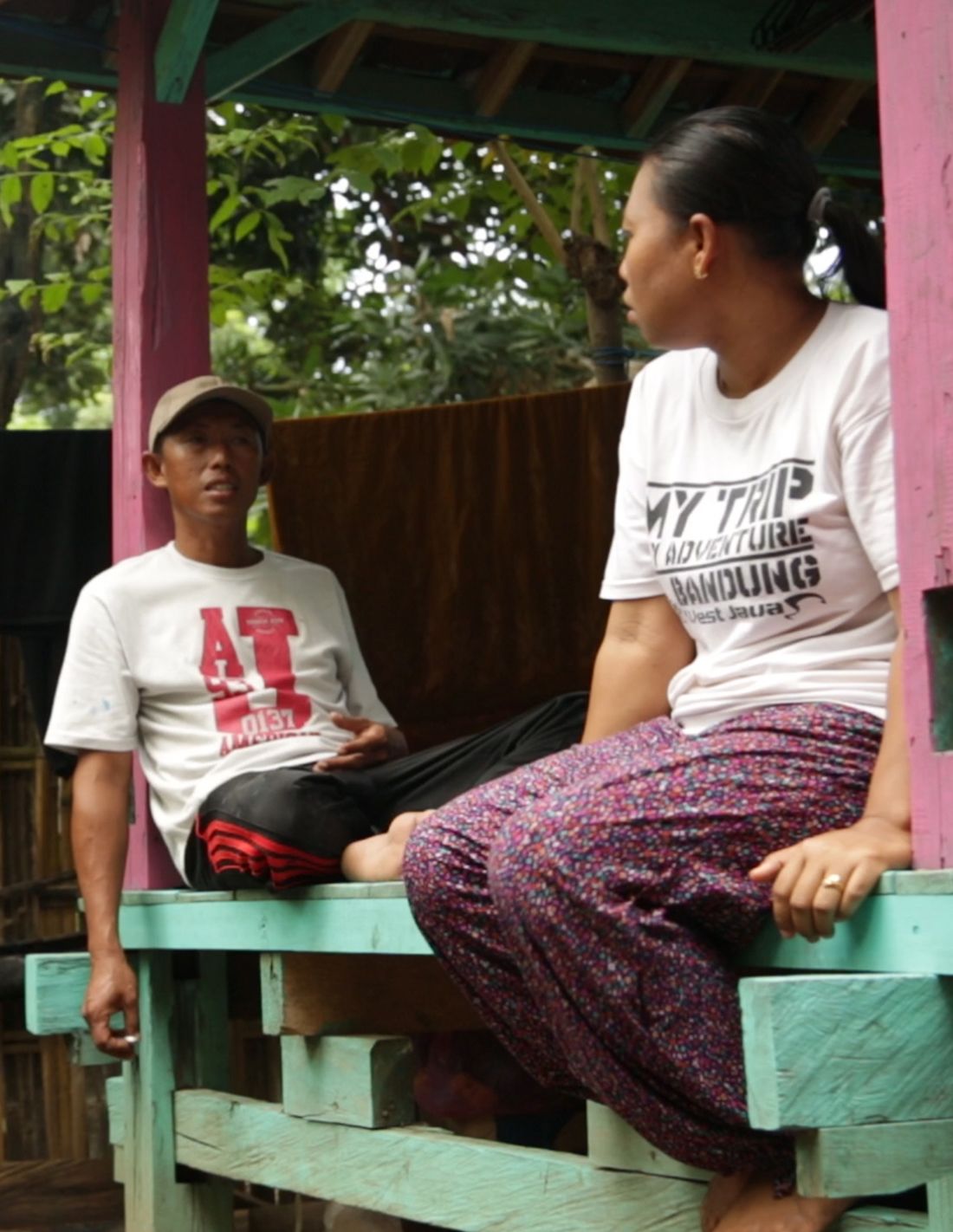
Arman sits with his wife at their home before a three week fishing trip. Around 6 million people in Indonesia rely on fishing for their livelihoods.
Arman sits with his wife at their home before a three week fishing trip. Around 6 million people in Indonesia rely on fishing for their livelihoods.
Around 6 million people in the Indonesian archipelago rely on fishing for their livelihoods. Illegal, unregulated and unreported fishing practices risk destabilizing a fragile ecosystem through the use of destructive fishing equipment, fishing in protected areas, and government quotas being ignored.
This technology is part of a new project led by Inmarsat, a commercial satellite operator, Indonesia’s Ministry of Fisheries — otherwise known as the KKP — and environmental consultancy PT Hatfield, through the UK Space Agency as part of the International Partnership Programme. The overall aim of the initiative is to improve the sustainability of Indonesia’s fisheries and, within that, help secure the livelihoods of the fishermen, reduce safety concerns through improved connectivity, and encourage less environmentally damaging fishing practices. The VMS device is also used by a patrol boat with the aim of helping prevent illegal, unreported, and unregulated — or IUU — fishing.
PT Hatfield Indonesia's head of marine unit Lida Pet-Soede explains how satellite technology is supporting sustainable Indonesia fisheries.
“Being able to engage both people at sea who observe things every day … and helping the government have better information, will improve sustainability of the fish stock and also help protect the important productive ecosystems of Indonesia.”
Read more: Connectivity matters for sustainable fishing in Indonesia